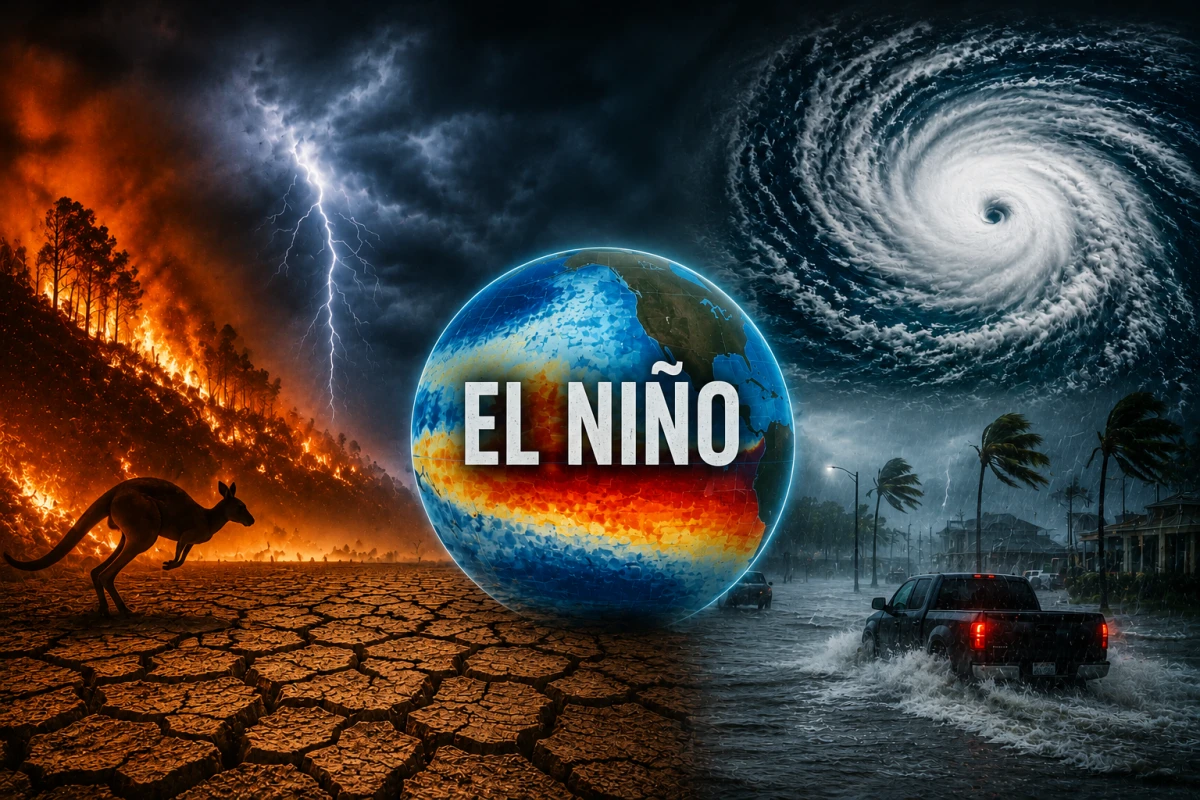
The World Meteorological Organization (WMO) has warned of a high likelihood of the El Niño phenomenon occurring in the coming months. Experts estimate that it could amplify the effects of global warming, trigger extreme weather events, and lead to new climate records.
The world must prepare for an increase in heatwaves, droughts, floods, and other extreme weather events amid the return of El Niño — the warm phase of the natural climate cycle in the Pacific Ocean.
On Tuesday, the World Meteorological Organization (WMO) reported that the likelihood of El Niño developing from June to August is 80%, and by November, it rises to 90%.
The return of this phenomenon means a temporary additional rise in global temperatures beyond the existing warming caused by human activity and climate change.
El Niño also affects the distribution of precipitation worldwide. In some regions, it leads to heavy rains and flooding, while in others, it causes prolonged droughts and water shortages.
"El Niño conditions are pouring fuel on the fire of global warming," said UN Secretary-General António Guterres.
According to him, the global community should view the situation as a serious climate warning.
The Impact of El Niño on Food, Energy, and Health
Experts warn that the consequences of the phenomenon could affect agriculture, hydropower production, and demand for electricity for cooling.
Against the backdrop of already existing food and energy supply issues, the situation could become further complicated.
"Extreme heat is already one of the deadliest climate threats. El Niño has the potential to amplify this danger," noted WMO Secretary-General Celeste Saulo.
According to her, the world may face an increase in heat-related illnesses, a wider spread of insect-borne infections, and increased pressure on food and water resources.
How Strong Could the New El Niño Be
The scale of the consequences largely depends on the strength of the phenomenon. Some experts are already calling it a potential "super El Niño," although the WMO does not officially use this term.
El Niño is considered very strong if the sea surface temperature in the relevant part of the Pacific Ocean exceeds the norm by more than 2 degrees Celsius. In the 21st century, this has only been observed during the 2015–2016 event.
According to several forecasts, including from the European Centre for Medium-Range Weather Forecasts, the current El Niño may not only reach this level but also exceed it.
The last episode of El Niño, which began in 2023, has entered the top five most powerful in recorded history and contributed to 2024 being the hottest year on the planet.
The WMO has already warned that a new strong event could lead to new temperature records in 2027.
However, experts emphasize that it is still too early to draw final conclusions about the strength of the current El Niño.
"We will talk about a strong or moderate El Niño when we are completely confident in the forecasts," said Saulo.
Which Regions Will Suffer the Most
Although El Niño contributes to a general rise in temperatures on the planet, its effects vary significantly across different regions.
According to the WMO, the southern states of the USA, some areas of South America, the Horn of Africa, and Central Asia may face increased precipitation, raising the risk of floods and landslides.
At the same time, Australia, certain regions of Latin America, Caribbean countries, South Asia, and Indonesia are more likely to experience drier conditions.
For Europe, predicting the consequences of El Niño is more challenging due to the continent's distance from the Pacific Ocean; however, experts do not rule out the phenomenon's impact on temperature and weather anomalies.
Experts emphasize that El Niño alone does not necessarily lead to catastrophic consequences. However, its combination with ongoing global warming can significantly amplify climate risks, writes bb.lv. Therefore, early warning systems and countries' preparedness for extreme weather events will play a crucial role.