
Modern presentations dry up decision-making.
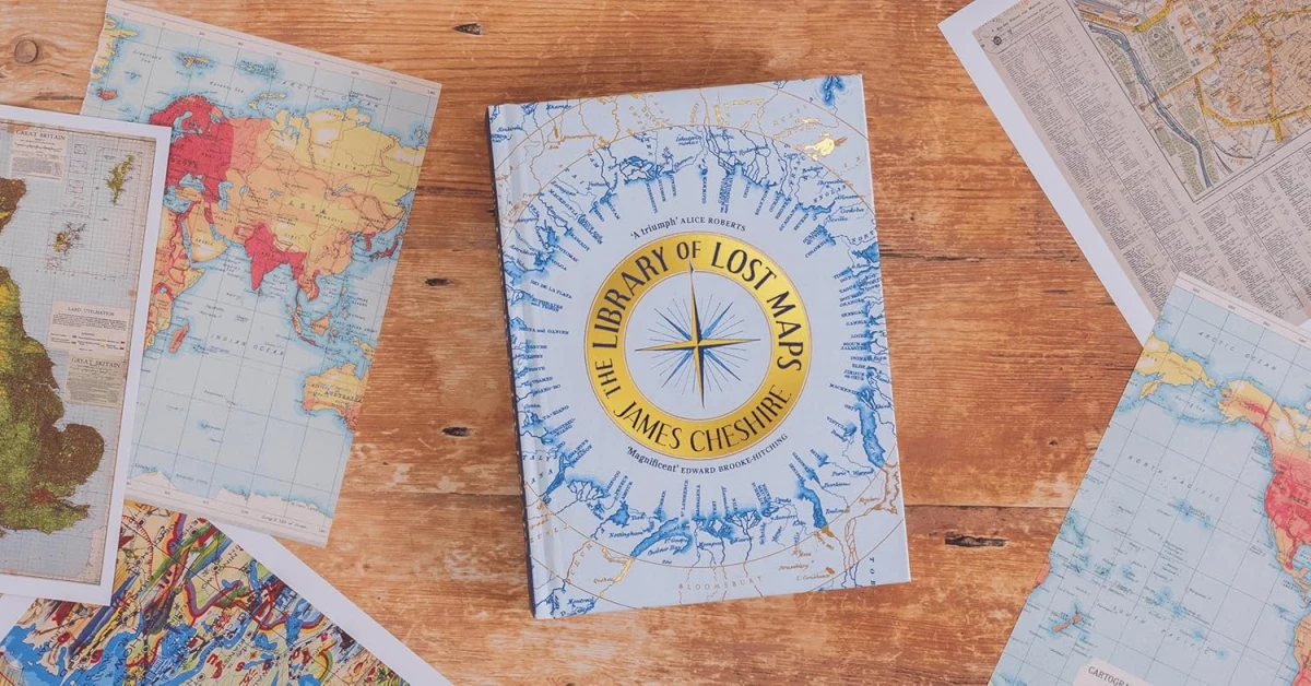
A forgotten university archive discovered by British professor James Cheshire provided him with rich material for research — not only cartographic but also broadly humanitarian. As a result, a book titled "The Library of Lost Maps" was created.
Several years ago, James Cheshire, a professor of geographic information and cartography at University College London, found an abandoned room on campus where geographical maps were stored. At that moment, he had no idea that he would spend three years in this dusty room among 440 special boxes, sorting through an extensive collection of ancient maps — both secret and not. The result was a book that details the curious facts uncovered by Cheshire and fully pays tribute to the analog culture and significance of cartography.
Almost a hundred "forgotten" images of the Earth's surface, studied and presented by the author in the work "The Library of Lost Maps," belong to different eras, geographical regions, and geological landscapes. Some of these sheets were nearly falling apart in his hands, while others, having not seen the sun and not served people for several decades, were surprisingly well-preserved (for example, a map of Hiroshima printed just weeks before the atomic bombing).
Among the finds was one of 34 copies of the first geological map of the entire Indian subcontinent. Compiled by Victorian-era cartographer George Bellas Greenough, this enormous map has double historical value, as Cheshire notes, its creator was one of the first to "recognize the potential of geographical maps as something more than just a tool for guiding people." Greenough took over a decade to outline just the sketchy contours of this map.
Speaking about the modern era of digital maps, Cheshire emphasizes the importance of having as much digital cartographic data as possible that can be applied for education, research, and other purposes. Such data is not only easy to update but also to use in the most rational way. The author of the book writes: "As a cartographer, I live in a world that previous generations could hardly have imagined." Nevertheless, in response to the rhetorical question of whether artificial intelligence will completely replace geographical maps in their traditional form in the future, he firmly says no.
Nowadays, most business meetings and diplomatic negotiations take place against the backdrop of pre-prepared presentations. This is how data is exchanged, reports are disseminated, and challenges are discussed. This format, often dry, impersonal, and highly visual, does not help with direct engagement in solving personal and local aspects of such contemporary issues as urban planning, peace negotiations, school education, or even ordinary tourism. "The Library of Lost Maps" raises the question of what changes when people are offered not just to familiarize themselves with information but to physically interact with it.
Walking through the halls of the National Postal Museum in Washington, the author of the book reflects on why not create a similar museum dedicated to maps. Indeed, they connect the past with the present, serving as arbiters in how humanity defines its path of development. According to Cheshire, "maps have it all." And if you look closely, you will find that there is a map for everyone that they would want to hold in their hands.


Leave a comment